Groundwater modeling module of the Advanced Hydrogeology course is designed to give students an insight into the open source modeling tools commonly used in groundwater assessment. Students are asked to investigate the potential groundwater contaminants for a hypothetical landfill site. The objective is to model the groundwater flow direction and estimate the travel times of contaminants to a nearby lake using ModelMuse. The input data is provided in various formats; namely precipitation and temperature data as a time series, geological data about soil and bedrock types and concentration of different contaminants at measured time.
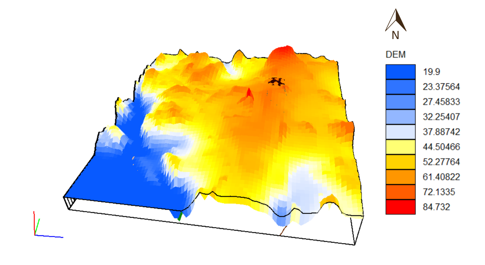
This is what the DEM of the area looks like.
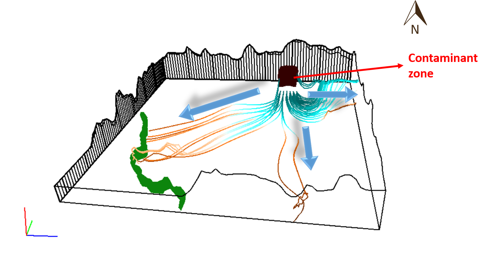
The groundwater flow path lines simulated using Modpath solver within ModelMuse is shown below. Early observations of the groundwater flow show that the contaminant zone sits upon a groundwater divide which is fairly captured by the model, i.e. diverging flow pathlines.
For someone interested in learning more about the groundwater modeling, here is a list to get you started…
- ModelMuse Videos
- Hatari Labs
- USGS manuals of various solvers (MODFLOW,MT3D,MT3DMS) have comprehensive list of examples.
- PMWiN 5 manual could be a useful resource too.
Caution:
Any modeling exercise is build upon assumptions that simplifies the problem therefore the results should be interpreted carefully. In this case, model captures the general groundwater flow direction; however, it is very sensitive to hydraulic conductivities and recharge values.